Pages

Wednesday, June 11, 2008

Winding My Way Home

Leaving the Sunshine Coast on the Queen of Surrey, we went on the top deck, and found a breeze.


For Aimee

Proof that the sky is still blue - there is hope for your holidays - this is inspiration for bathing suit shopping. The shot was taken on the wet day I left the lower mainland.


Spotted Lake

On the journey home, I stopped at the small water hole just outside of Osoyoos that always looks quite strange. When driving by, we can clearly see the circles on top of the lake; depending on the time of the year, those circles change. I found out that it has a name - Spotted Lake. Spotted Lake is a sacred medicine lake of the Okanagan People.

"It is a rare natural phenomenon covering 15.2 hectares (38 acres), containing one of the world's highest concentrations of minerals: magnesium sulfate (epsom salts), calcium and sodium sulfates, plus eight other minerals and traces of four more, including silver and titanium. As the summer progresses the lake dries out, its mud forming into white, pale yellow, green and blue circles depending on its mineral composition. Known as Kliluk to the natives of the Okanagan Valley, the lake is a sacred and culturally significant site whose potential for commercial exploitation recently generated much controversy."

The controversy has to do with the healing properties of the water.

Here it is close up:


Palindrome

This goes into the category of "ways to amuse myself on a road trip."


Paulson Mountain

Over the Blueberry Paulson, there is a special mountain that we get to see for 3 brief glimpses; the view is most spectacular on the way home, though it is quite elusive for the clouds like to linger. Rare is it to catch the view but this trip I did:

Monday, June 09, 2008

Gibsons Landing


Our second stop on the Sunshine Coast was Gibsons Landing; in actuality it is closer to the ferry than Sechelt. But we drove up the coast, and then came back to Gibsons Landing. Gibsons Landing gains its fame from The Beachcombers, which was filmed here from 1972 to 1990. Both the pier and Molly's Reach are still standing. In fact, Molly's Reach only became a restaurant after the end of the series.

Here it is:


We didn't actually eat at Molly's Reach; we chose Gramma's Pub, from a suggestion from a receptionist in Sechelt. The highlight of the meal was chicken wings.

And then we strolled down the pier:


And saw an avid gardener's work, who definitely was undaunted by the problem of water all around:


Vancouver is 10 miles away, if you were a bird. With the laidback atmosphere and abundance of outdoor delights, Gibsons is a great place to hang out. If only for a day....

Sunday, June 08, 2008

Sunshine

We found the sun! Interestingly enough, we travelled to find it. Sunshine Coast. How well named.

Josh and Aimee each had a day off on the day I wanted to go see a part of British Columbia I have never seen. I have some vague memory of it from watching the Beachcombers on Sunday night television for years. Getting to the Sunshine Coast requires a ferry ride. There are also two other choices: a plane or a very long hike.

We went to the Lower Sunshine Coast. There is another ferry ride to take people to Powell River, further up the coast. Here is a description from the Sunshine Coast Employment Centre:

"The Lower Sunshine Coast is home to approximately 26,000 people and is a diverse community with unique challenges and opportunities. Accessible only by ferry or air, the "Coast" is a conglomerate of a number of self-contained communities that stretch along a ribbon of highway, 150 kilometers long, from Port Mellon to Egmont."

Our first stop was:


We found our way to the ocean:


Sechelt means land between two waters. An isthmus a friendly resident told me. He said to be sure to go to Porpoise Bay. This is the sandy side of the water. The tide was out so we got to see many gifts from the sea:


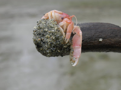
This next photo was a baby lobster who Josh rescued and sent back to the sea.


We combed the beach, and I chatted with a biologist from the San Juan Islands who gave me a brief introduction on the stories the sand tells. I learnt about lug worms, and how vital they are to the health of a beach; and I learnt how to detect lug worm shit, because of course the actual worm dwells under the sand. I am delighted to report that there were many sightings of lug worm shit.

And the sun shone. At last we got our RDA of Vitamin D.

Josh's summation of Porpoise Bay: "There are no porpoises here. They should have called it Bay."

Saturday, June 07, 2008

White Rock

Lots of rain this journey. The good part is that Rose, who is taking care of my garden back home, has a light load. The bad part is though I remembered to bring a jacket that is water resistant, it is getting old now and has a couple of leak spots, and I have no umbrella. I did bring my closed-toed shoes. I am not sure I would call what has been happening here rain; it is more like a shower from the universe.

One day Josh and I hung out, some of it in front of the TV. Him and I had a discussion about watching the weather forecasts; he likes to know what to expect. For me, when I saw that the next 5 days of my holidays were going to be rain-logged, well... I wasn't delighted. Wouldn't it be better, I said to him, to wake up each morning, hopeful about possibilities of sun?

As one woman I met this journey said, "Enjoy the rain. That's what you got." While perhaps I didn't enjoy the rain all the time, I didn't let it stop me.

My journeys this week have been around various cities on the lower mainland. I have been to Cloverdale, Langley, New Westminster, Downtown, and Surrey.

And White Rock.

My friend, BJ, who lives in Bellingham suggested that we go for dinner. We agreed on White Rock, which is close to the Washington border, and perhaps a half way point. We each left at 5 pm; I was at Brentwood Mall, minutes from the freeway. My task was to get travel down the freeway for about 20 kms and then it was about another 8 kms to White Rock. Everyone who lives on the lower mainland, it seems was on that freeway at that time. BJ called me on my cell at 5:35 to say that she had arrived. Luckily she brought a book. I arrived at 6:15, very road weary. White Rock is a good antidote.

We ate at Moby Dick's, a popular place that serves fish and chips. Here's a trick for ordering fish and chips at Moby's - they always add on another piece. So if you want two pieces of fish, order one. If you want one piece, well, I think you are hooped. Moby's is one happening place; it is small and busy; tables move quickly. BJ and I agreed after ordering coleslaw to pass on that menu item. The woman at the next table said, actually don't order anything green. Otherwise, it was a hit! Pretty different fare from what my body has been used to; not a good day to forget the digestive enzymes at home.

After our dinner, we walked along the ocean on a delightful seawall. It was here that I learned how the place got its name:


This is not a small rock; here I am reading the writing on the rock:


Here is the Wikipedia description of how the white rock landed where it did:

"White Rock is named for a distinctive large white boulder found on its beach near the promenade. A glacial erratic that migrated south during the last glaciation. The 486-ton granite boulder was kept white by shellfish-eating seabirds, whose guano covered the rock, so much so that sailors in the 19th century used it as a beacon. However, it now remains white through frequent applications of white paint by the city parks department, as it has been a popular graffiti target for over thirty years."

Another famed event attached to White Rock was a sandcastle competition, which began in 1979 and ceased in 1987; it had international status.

"A revival of the sandcastle building competition as a family event is being held August 3, 2008 during the 59th Annual Spirit of the Sea Festival."

Here's the info: White Rock Sandcastle Competition

Apparently White Rock has more sun that Vancouver. And it did look like there were possibilities:


Well, as I have not been watching the weather forecast, there are many possibilities.

Friday, June 06, 2008

To the Coast

On May 31st, I left Nelson to travel to the coast. The day began bright and sunny, an inspiring drive.


The first mountain pass is about an hour for home. Here is the top:


Descending from the Paulson Summit, the next community is Christina Lake. The land offers the lake in a spectacular surprise; the road winds around a corner, and then the lake pops into view. This sight can only be viewed one way. The charm of driving in the mountains is that the road looks completely different going the other way.


There are 5 mountain passes between Nelson and the lower mainland. Mountains everywhere.

In front:


And behind: